Heat-Sensing Drones Open New Frontiers
By Bárbara Sellés Ríos

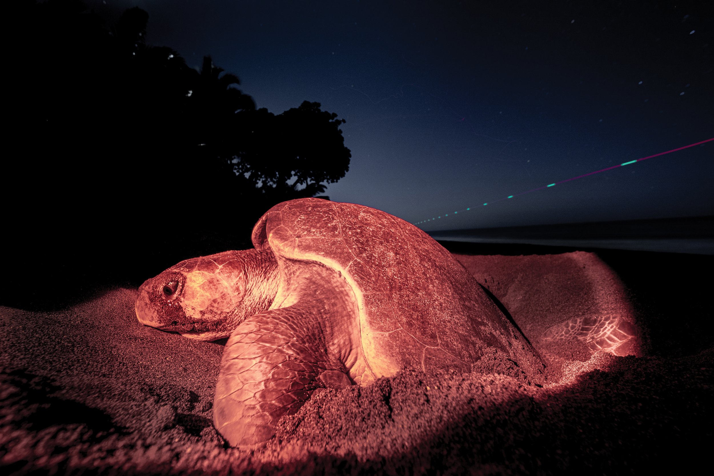
Certified drone pilot and local community member, Johan Ortiz García, flies a drone outfitted with thermal infrared sensors over Piro Beach, Costa Rica. © Andy Whitworth;
Hundreds of sea turtle projects monitor more than 3,200 nesting beaches globally, with volunteers walking for countless long hours on sometimes dangerous beaches alongside drug traffickers, poachers, native and feral animals, and other hazards. The fast growth of drone technology holds great promise for easing the challenges of such work while allowing for greater accuracy in species identification, for monitoring of mass nesting events, for studies of adult sex ratios nearshore, for pinpointing of tagged individuals, and more.
Drones equipped with thermal infrared sensors (TIR) have more recently expanded the scope of such work by augmenting daylight visual observations with the ability to view nighttime temperature signatures of animals and their surrounding environments. Nocturnal testing of TIR-equipped drones in Mexico and Cabo Verde has proved useful in detecting human and feral animal presence on nesting beaches. Moreover, at one site in Cabo Verde such tools helped to significantly reduce rates of poaching (see SWOT Report, vol. XVII, p. 8).
Informed by such initial studies, researchers at Piro Beach (Osa Peninsula, Costa Rica) began nocturnal drone surveys in 2021 and verified that the drones could effectively spot sea turtles and tracks; differentiate between adult olive ridley and green turtles; and see hatchlings and wildlife (raccoon, coati, wildcats, birds, and bats), as well as humans, on the beach at night. Using an Autel Robotics drone (EVO II Dual 8K and Autel Explorer App), a team of two biologists observed TIR images in real time and tested different camera gimbal angles (90, 45, 35, and 18 degrees), heights (from 80 to 4 meters), and visualization modes (“black hot,” “white hot,” and “hottest”) to determine optimal camera settings for sea turtle work.
The lights from a passing drone can be seen patrolling the beach while an olive ridley nests under the cover of darkness on Piro Beach, Costa Rica. © Andy Whitworth
The team concluded that to best identify turtles and ensure greatest coverage of the full width of the beach at Piro, the optimal camera angle was 35–45 degrees downward from horizontal at a height of 50 meters above the ground. At that altitude, the drone was inaudible because of the overpowering sound of waves, though its positioning lights were still visible. Nonetheless, even when the drone was flown as low as 4 meters above a turtle engaged in nest covering and camouflaging, the animal appeared to be unperturbed; though at such a low altitude, the drone landing lights turn on automatically, which could deter more light-sensitive species or individuals.
Regarding the thermal camera visualization mode, no significant difference was noted between the “white hot” and “black hot” modes, though the latter was judged better for detecting fine-scale features. Further comparative studies between foot and drone patrols showed that the thermal drones detected 20 percent more nesting activity (sea turtles and tracks) than did human patrollers. Drones were also better at spotting other potential predator animals and humans, including three potential poachers seen by the drone that the foot patrols missed altogether.

An image captured using a drone’s thermal infrared sensors shows an olive ridley emerging from the sea with its track visible behind it. © Osa Conservation

An image captured using a drone’s thermal infrared sensors shows an olive ridley emerging from the sea with its track visible behind it. © Osa Conservation
Despite the promising results, we should consider some challenges and limitations before investing in a shift to aerial surveys using thermal drones. Some tracks and turtles at Piro Beach were hard to identify and easy to confuse with other marks on the sand, such as those made by wave action. And sea turtles were often difficult to tell apart from logs, debris, and other beach features. Also, though each video lasted 21–25 minutes, the video analysis typically required an added 45 minutes to prevent double-counting of tracks and other potential errors, though this is a challenge that could be addressed through a higher resolution TIR camera and by georeferencing tracks with artificial intelligence as they are counted. Because sand and sea turtle temperatures need to be significantly different to ensure proper thermal detection, further testing on beaches of varying sand color and heat retention are needed so we can understand the beach types where thermal drone work can be most effective.
Other factors to consider are the possible negative impacts of moonlight or artificial lights, which other projects have suggested contribute to a reduction in animal detection using TIR drones. Finally, the cost of this technology may be a barrier; the drone used in this study cost around US$10,000, though other models—such as the DJI Mavic 3 Enterprise Thermal camera—also hold great promise, yet at a lower price. Therefore, the authors recommend testing a variety of models for their cost-effectiveness and potential light and sound effects on nesting sea turtles before embarking on a long-term thermal drone monitoring effort.
TIR drones, human beach patrols, and effective local law enforcement present a powerful and complementary set of tools to combat important threats on sea turtle beaches while also supporting monitoring and research goals.
This article originally appeared in SWOT Report, vol. 18 (2023). Click here to download the complete article as a PDF.